
bc – Site Sense, Baseline Road Corridor Public Art Project
Phoenix, Arizona, United States [2002]
The work evolves with the site by responding to processes that continually reshape it: weather, seasons, growth, and community. It proposes a network of interventions that will both reveal the passage of time in this place and suggest the potential of future time passing. Central to the project is the human experience; the warmth of the desert sun, the placement of a foot on the ground, the draining of water, the memory of the ancient cultures living in this place.
Five intersections along with five conceptual strategies are proposed for Baseline Road:
To create a new order between 3rd avenue and 40th street by establishing a series of north – south zones that will respond to the historic and sensual qualities of this place. To give prominence to the major north-south streets by lining them with rows of trees that recalls the pattern of the orchards. Each street would have one tree type assigned to it, giving each street its own identity. To acknowledge the shifts that occur at each intersection, the work develops an event that will refer to a moment in the history of this place.
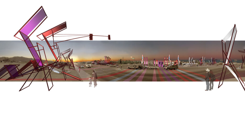
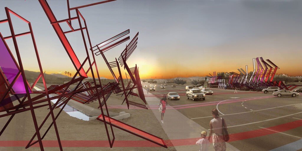
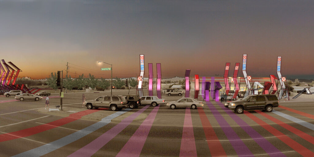
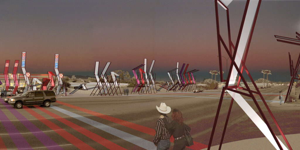
_ ‘Go’ Flowers/Overlap: At the intersection of 40th Street and Baseline Road, a gateway that reminds one of the beautiful flower fields that once filled this section of the corridor with color and the Japanese-American families that grew and sold the flowers. As well, to re-tell a moment from the past when the flower fields were left colorless and the families that owned this land were sent away to internment camps. In Phoenix during World War II all Japanese-Americans living South/West of a line drawn from what is now Sun City to Mesa were held in captivity in Poston, Arizona. At the site ‘Go’ Flowers this story is re-told with the overlap of a giant ‘Go’ grid and a series of structures that intensify a remaining section of flower fields.
‘Go’ is a 2,000 year-old Asian board game, which is played by alternating the placement of round “stones” on the intersections of line within a 19 by 19 grid. The stones function as fence posts, and are seen to link together to form walls. ‘Go’ is a game of internment, of surrounding, and confining. The game was a popular pass-time for the confined Japanese-Americans during the war and continues to be played today.
Here the geographical and ideological boundaries that were fought over during the War are presented by drawing the 19 by 19 grid over the site. The lines of the grid are to be surveyed with same Initial Point that Arizona was surveyed from. At the intersections of the ‘Go’ lines are placed markers with the names of the Japanese-Americans placed in Internment Camps each with the flower that recognizes the month and date of their birth. The lines are interrupted and broken by development since the 1940s. In places they are made visible by etching them into the surface of the ground in a way similar to ground lines drawn by numerous ancient communities.
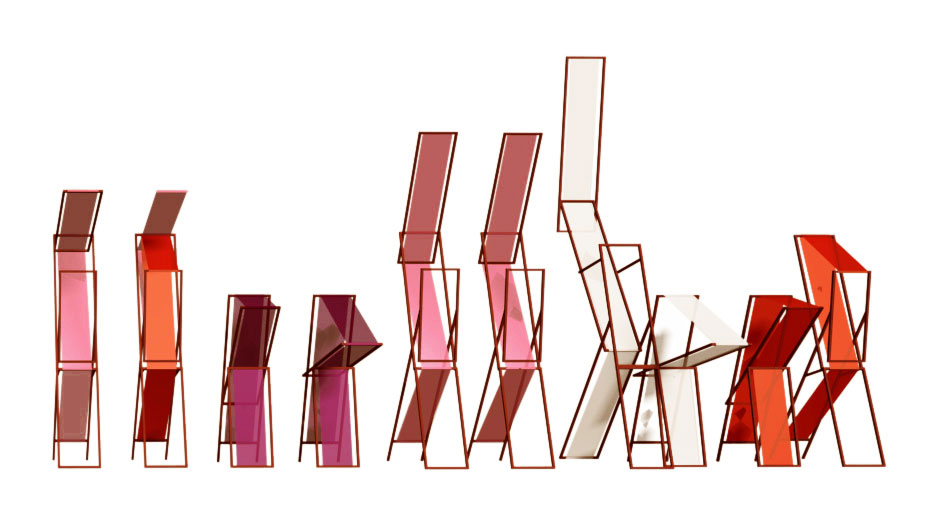
The idea of the flower frames is to intensify the color of the fields by extending it vertically and horizontally across the site. The frames are built with steel in varying sizes and complexity according to the program that they support. For example, these structures can act as shading devices, bus stops, cooling and lighting systems, plant and fruit stands, trail markers, information story-boards, and recreation equipment. Within the frame structure it is placed translucent material that will reflect color onto the surface of the ground.
_ Whispering Orchards and Light Waters/Sensitize: At the intersection of 32nd Street and Baseline Road the work sensitizes one of the citrus orchards. The scent of blossoms, the casting of shadows, the reflection of irrigation waters, the sound of the breeze in the trees, and the taste of the fruit gave this area a unique sensual experience in the valley.
To re-make the grid of the fruit trees with interactive devices that measures the velocity of the wind and fill the air with whispering sounds. These pieces are made with hollow steel tube of varying diameters and configured with the structural order of a tree. When wind passes through the tubes the height and diameter determines the pitch of the sound while the movement of the wind determines the sound’s amplification. Small openings at the base of the pieces would enable visitors to “play” the orchard as one might a flute.
As well, to celebrate the irrigation water system by allowing a small amount of water from the Western Canal to fill new trenches that run parallel to the Whispering Orchards. The trenches are constructed such that downhill flow of water is brought to a point at the street where it would drop into troughs for the horses along the recreation trail to drink. From the trough the water then flows into a second trench that will cross the street and fill an interactive water feature with the words “Baseline Road” written in Japanese.
_ Sube y Baja/Modify: At the intersection of 28th Street and the Highline Canal it is recognized the coming together of two communities of differing ethnic, economic, and social backgrounds. In response to the request for a vehicular bridge that would connect 28th Street across the Canal it is used the object “sube y baja” or “teeter-tottor” to bridge the canal over and again between the community centers of church and elementary school that bound this site. The Sube y Baja becomes an interactive bridge that will move with the crossing of pedestrians over the canal. The Sube y Baja modifies the function of the canal. Once a water source for agriculture, now this segment of the canal is a type of spine that supports and encourages community connection.
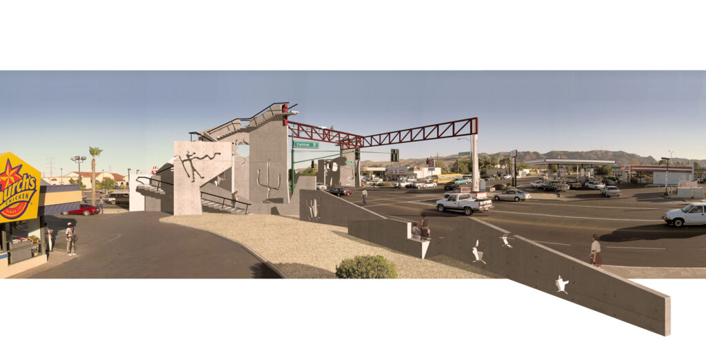
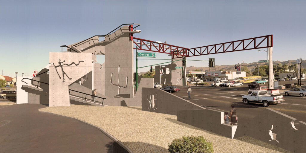
_ Spirits Trailings/Situate: At the intersection of Central and Baseline Road gets situated a gateway to South Mountain Park. Here the mountain trails are brought down to the street making the trail experience accessible to all and facilitating the crossing of a busy intersection. From the many segments of the new trail near and distant views are framed by the concrete walls. As South Mountain does, our trail will provide amazing panoramas of the urban landscape. Cut into the walls of our mountain are silhouettes of spirits carved by ancient Indians onto the rock of South Mountain. Light passing through our walls allow the spirits to move freely through the intersection.
_ Sunny Moon/Intensify: At the intersection of 3rd Avenue and the Western Canal is proposed a public park called Sunny Moon. Here skate boarders and park enthusiasts enjoy a landscape of partial spheres that record the passage of seasons, time of day, and moments of historical significance to the Baseline Corridor. Similar to the observatories of ancient agricultural communities, the constructions intensify time as the constant that unites past to present and into the future.
Status: Schematic Design, Public Art National Competition Entry, Awarded Finalist
Design: Claudio Vekstein in collaboration with Catherine Spellman, Archs, Heidi Hesse, Artist and Kristina Floor, Lands Arch
Design Assistants: Ankur Jain, Brian Schroeder, Michael Groves, Renders Alejandro Goldemberg, Archs
Consultants: David Foster, Literature Prof and Dale Wiggins Civil Engineer with URS Greiner
Client: Phoenix Arts Commission, City of Phoenix
Location: Baseline Road between 3rd Ave and 40th St, Phoenix, Arizona, United States
Area: 10 ha
Photography: Alessandro Desogos